Ideas for Integrating Google Maps into Other Lessons
As I explored the capabilities of this website my mind swarmed with ideas of how to use it in the classroom. My background in elementary education may show in the list of ideas I developed. Below is a detailed integration idea on using Google Maps to present class research projects. I have also included a few other ideas at the bottom of the page.
State Research Projects
Grade level: 5th grade
Prerequisite: Prior to this project students should take part in a minilesson about Google Maps and how to annotate.
Objectives:
1) Conduct research about a state using multiple resources.
2) Select appropriate and relevant information to include in a written report.
3) Build and understanding of Google Maps and recognize their usefulness as a way to present and share information.
Procedures:
1) Students use multiple sources to collect research on at least three major landmarks in a state. Students can work individually or with partners.
2) Students type a paragraph about each of their landmarks in a word processor. Using the word processor will help prevent spelling and grammatical errors.
3) Using a class Google Map or an individual Google Map students add placemarks at the locations of their three landmarks.
4) Students title their placemark and copy and past their paragraphs into the description.
5) Students add a picture to their annotation by either scanning their picture into the computer, downloading a picture from another source (check for copyright), or downloading from a camera.
Overall Idea:
Google Maps transforms an individual research report into a shared project. Technology and the desire to be a part of the finished product can provide motivation for completion. And, there are no fights over who will get to take it home because everyone can access it through the Internet or can be embedded into a class web page.
Other Integration Ideas
Classroom Community Building
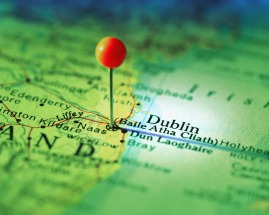
Use the map just as you would use straight pens to show where your students and students' families are from.
Keep track of fieldtrips the class goes on and allow students to write the descriptions of them.
Building Background
Use the map to locate places you read about in class. You could even keep track of the number of places you read about throughout the year to build cultural understanding and respect.
Geography
Build an understanding of "Bird's Eye View."
Locate different landforms using the satellite option (Google Earth is also great for this because the tilt option can show the height, width, and shape of real landforms).
Develop map skills.
History
Use the ability to draw lines on the map to show the distance a group of people had to travel (the pilgrims on the Mayflower, the trip enslaved Africans made from Africa to America, the Oregon Trail, the Trail of Tears.)
